 The Sustainable Raritan River Initiative (SRRI) produced Volume 1 of the State of the Raritan Report (Lathrop et al. 2016) to identify trends in key indicators of water quality and watershed health for the Raritan River basin that were originally assessed in the Raritan Basin: Portrait of a Watershed as developed by the New Jersey Water Supply Authority (NJWSA 2002). Eleven key indicators were assessed for Volume 1 including: population; housing units; urban land use; impervious surface cover; forested, coastal and emergent wetlands; upland forest cover; prime agricultural land; groundwater recharge; fish and macroinvertebrate bioassessments; riparian area integrity; and known contaminated sites and groundwater contamination. The trends evident between 1986 and 1995 are continuing in the same general direction though the rate of change in trends has varied over the longer time period. The trend impacts over the 20 plus years were either trending negative for water quality or could not be determined.
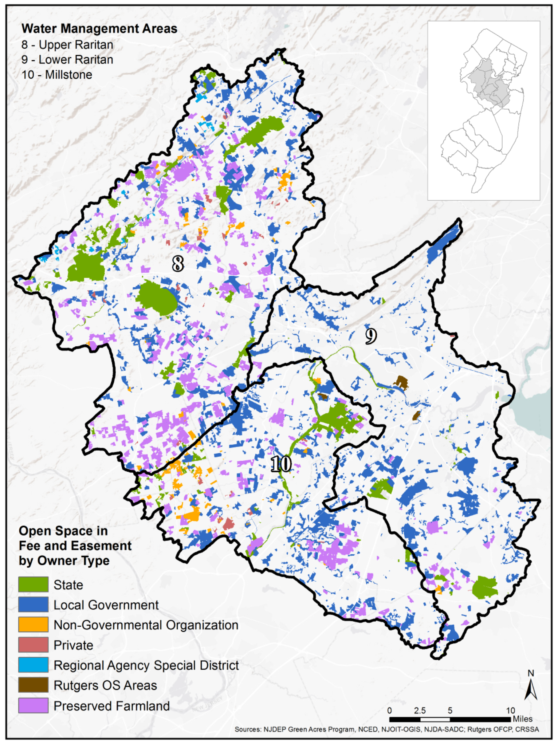
 Volume 2 of the State of the Raritan Report looks at a broader range of metrics for the health and livability of the Raritan River basin (Malone et al. 2019). The intent of the 2nd report was to capture readily available data; in most instances, the data collected did not have available historic data to identify trends. The majority of data in this document was, therefore, a report of status only but is still valuable to inform future watershed planning efforts. Volume 2 indicators include: canopy cover; known contaminated sites; threatened and endangered species; open space; recreation trails and greenways as well as boat launches; a summary of grey infrastructure including stormwater management basins, culverts, outfalls, bridges and dams; restoration projects; and resilience as measured by FEMA flood insurance payouts for recent historic storms in the basin.
Together, the two volumes provide critical data to inform planning and decision-making in the basin as well as to identify data gaps that will help set priorities for university-based research efforts. Our ultimate goal is to develop a baseline of metrics that can be used in the coming years to identify strengths and weaknesses in efforts to restore and protect Raritan resources and to help inform basin-wide stewardship and regional planning efforts for the Raritan.
To stay informed about our regional watershed management planning efforts, sign up for e-Newsletter & Announcements (bottom right of the website) or contact Sara Malone at raritan@ejb.rutgers.edu.
State of the Raritan Report, Volume 1 (pdf)
State of the Raritan Report, Volume 2 (pdf)
ArcGIS StoryMaps
In the Spring of 2019, undergraduate students in Dr. Richard Lathrop’s Advanced Environmental Geomatics course developed ArcGIS StoryMaps for key indicators identified in the State of the Raritan Reports, Volumes 1 and 2. Click on the links below to learn more.
- Bioassessment Tour of the Raritan Watershed by Sayra Reyes
- Dams in the Raritan River by Kiera Malone
- Fixing the Raritan’s Stormwater Infrastructure by Liza Chang
- Habitat Suitability for NJ’s Threatened & Endangered Species by Justin Martinez
- Housing Issues in the Rairtan Watershed by Alvin Chin
- Impervious Surfaces of the Raritan River and Surrounding Areas by Laura Vogel
- Known Contaminated Sites in the Raritan River Basin by Ryan Cooper
- Open Space in the Raritan River Water Basin by Eva Tillett
- Population by Abdullah Nasir
- Prime Agriculture by Jacqueline Cavaliere
- Raritan Basin Recreational Trails and River Access by Hannah Adickman
- Raritan River Tree Canopy Cover by Donna Climent
- Raritan Watershed Restoration Projects by Gretalyn Donato
- The Raritan Basin and Change in its Riparian Areas by Morgan Crooks
- Urban Land Use in the Raritan River Watershed by Amanda Lowell
